
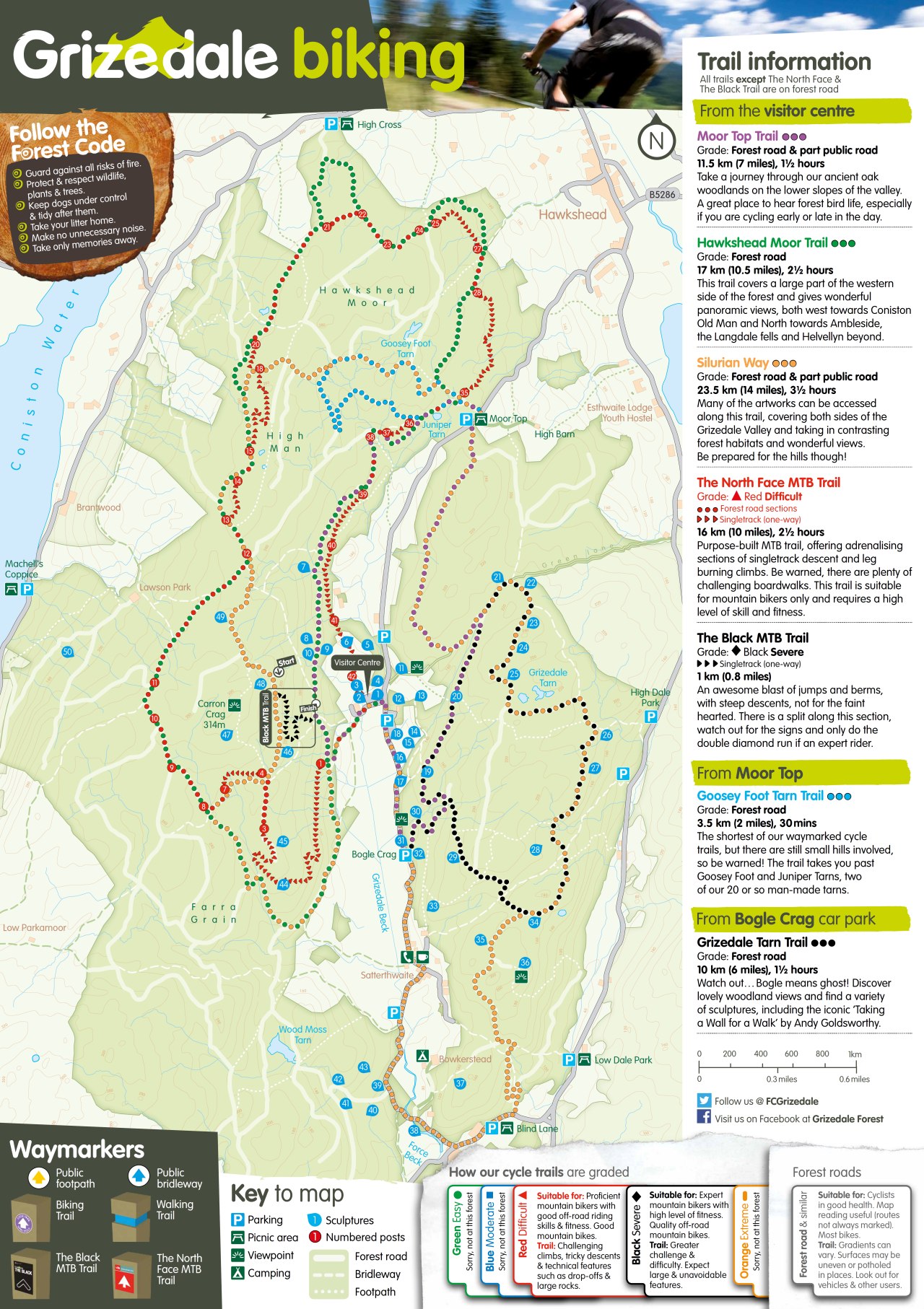
Moor Top Trail at Grizedale
Trail Summary:
- Ride Time: 1hr 30 mins
- Ride Distance: 10311 m
- Ride Climb: 266 m
- Ride Descent: -265 m
-
Route Starts from: Grizedale Mountain Bike Centre
PDF Map Download
Don’t forget a Map, GPS and Guidebook!


Ride Details
The Moor Top trail at Grizedale forest is the one of six waymarked routes that generaly follow forestry roads and non-technical in nature. After an intial climb, the route keeps high as it contours its way around the valley towards Moor Top, returning in the same vein on the opposite side of Grizedale.
The Moor Top Trail is waymarked in Purple.
The Moor Top Trail at Grizedale – Take a journey through our ancient oak woodlands on the lower slopes of the valley. A great place to hear forest bird life, especially if you are cycling early or late in the day.
Featured Image Credit: Photo by alx_chief on Foter.com / CC BY-SA


Ride Map and Elevation Profile
Download file for GPSRemember that you can download the GPX File for the MTB route above and use in your GPS device or on your favourite mapping app. We’ll have a run down of how to use GPX files on your MTB route soon.
Base Summary: Grizedale Mountain Bike Centre
Grizedale along with Whinlatter near Keswick, is one of two MTB centres in the Lake District run by Forestry England. It is located between Coniston Water and Windermere, a few miles south of the village of Hawkshead. Grizedale is a family oriented centre, with numerous easy forestry road routes and only two technical routes for more accomplished MTB riders. Though there are a number of unofficial off-piste routes and enduro lines such as The Viking as well as an extensive network of bridleways to be explored.